
Connect PostGIS with pygeoAPI
Posted on January 20, 2025
3 minutes
PygeoAPI is an efficient way to expose geospatial data via OGC-compliant APIs like OGC API — Features. It allows you to serve vector and raster data seamlessly, making it accessible to web and desktop applications.
Prerequisites
- PostGIS: Ensure you have PostgreSQL with the PostGIS extension installed.
- Python Environment: Use Python 3.8+.
- PygeoAPI Installed: Install PygeoAPI and dependencies.
Installation
To integrate PygeoAPI with PostGIS, install the required Python libraries:
pip install geoalchemy2 psycopg2-binarygeoalchemy2: Provides support for PostGIS queries.psycopg2-binary: PostgreSQL adapter for Python.
Add PostGIS as a Resource in PygeoAPI
Edit the PygeoAPI configuration file to add a new resource for your PostGIS table.
imp-places:
    type: collection
    title:
      en: Important places
    description:
      en: All important places in world
    keywords:
      en:
        - places
        - point
        - important
    links:
      - type: text/html
        rel: canonical
        title: information
        href: https://www.naturalearthdata.com/downloads/10m-cultural-vectors/
        hreflang: en-US
    extents:
      spatial:
        bbox: [-180, -90, 180, 90]
        crs: http://www.opengis.net/def/crs/OGC/1.3/CRS84
    providers:
      - type: feature
        name: PostgreSQL
        data:
          host: 127.0.0.1
          port: 5432 # Default 5432 if not provided
          dbname: postgres
          user: postgres
          password: postgres
          search_path: [public]
        id_field: id
        table: places
        geom_field: geom
Explanation:
type: collection: Defines a collection of features.providers: Specifies PostgreSQL as the data source.- `Database Credentials ` : Replace
host,dbname,user, andpasswordwith your database details. table: The table in PostGIS containing your geospatial data.geom_field: The geometry column storing spatial data
Generate the OpenAPI Definition
After configuring your resource, generate the OpenAPI documentation using the following
pygeoapi openapi generate $PYGEOAPI_CONFIG --output-file $PYGEOAPI_OPENAPIReplace:
$PYGEOAPI_CONFIG: Path to your PygeoAPI configuration file.$PYGEOAPI_OPENAPI: Desired output file for the OpenAPI documentation.
Run PygeoAPI
Start the PygeoAPI server to serve your PostGIS data:
pygeoapi serve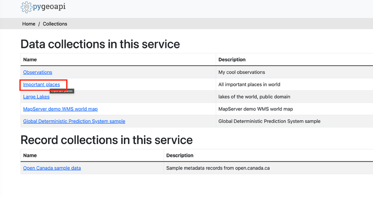
Query Your Data
Fetch All Data
Retrieve all features from the imp-places collection:
http://localhost:5000/collections/imp-places/items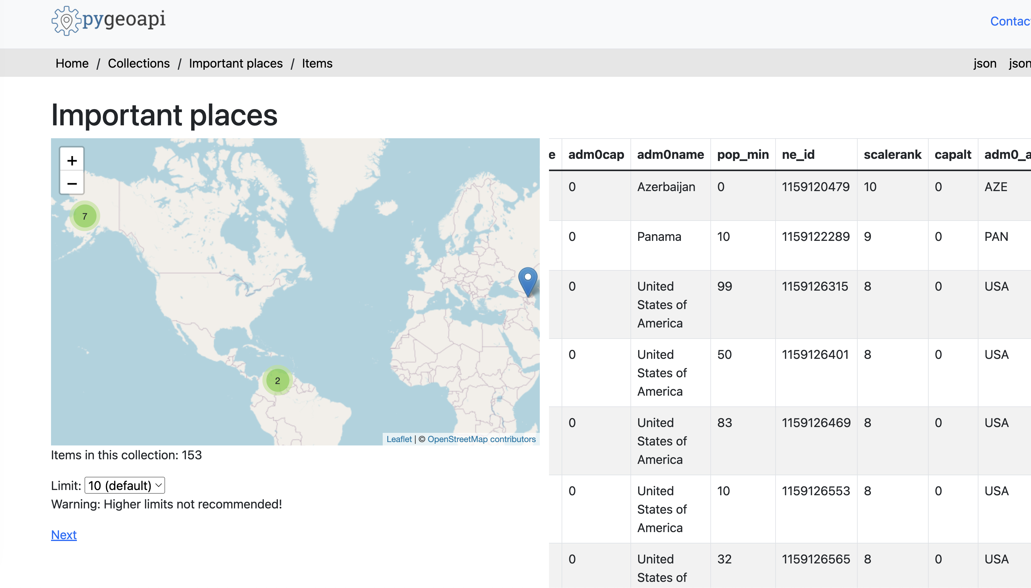
Filter by Bounding Box
Fetch features within a specific bounding box
http://localhost:5000/collections/imp-places/items?bbox=73.084466,16.734051,81.208856,21.752345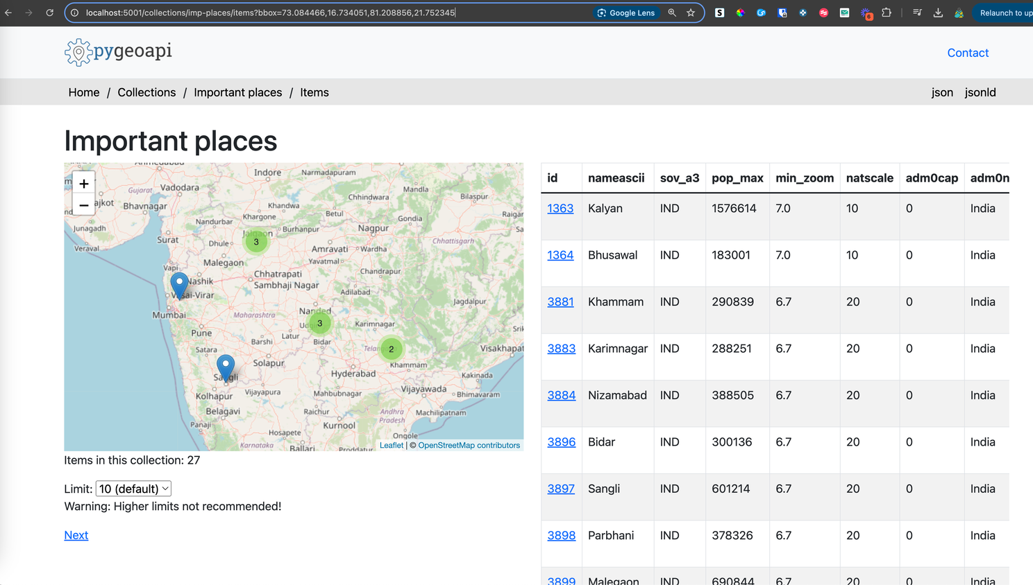
Sort Features
Retrieve features sorted by the name attribute
http://localhost:5001/collections/imp-places/items?sortby=nameFilter by Comparison Operators
Use comparison operators in your filter expressions, such as =, !=, <, >, <=, and >=.
Example: Retrieve places with population less than 100:
http://localhost:5000/collections/imp-places/items?filter=pop_min<100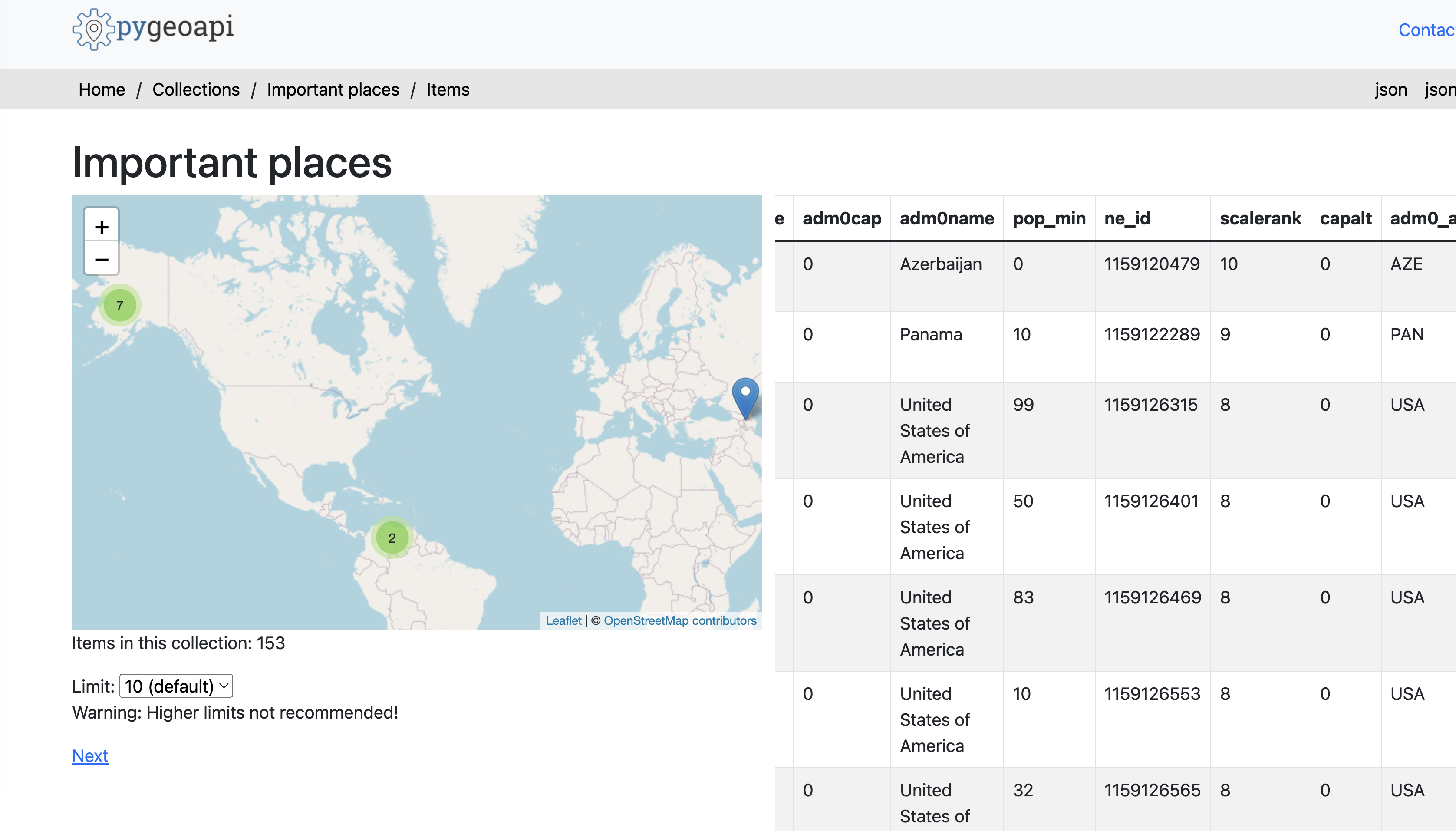
Filter by Like or Pattern Matching
Use the LIKE operator for pattern matching on string attributes.
Example: Retrieve features where the adm0name attribute starts with "Ind"
http://localhost:5001/collections/imp-places/items?filter=adm0name LIKE "Ind%"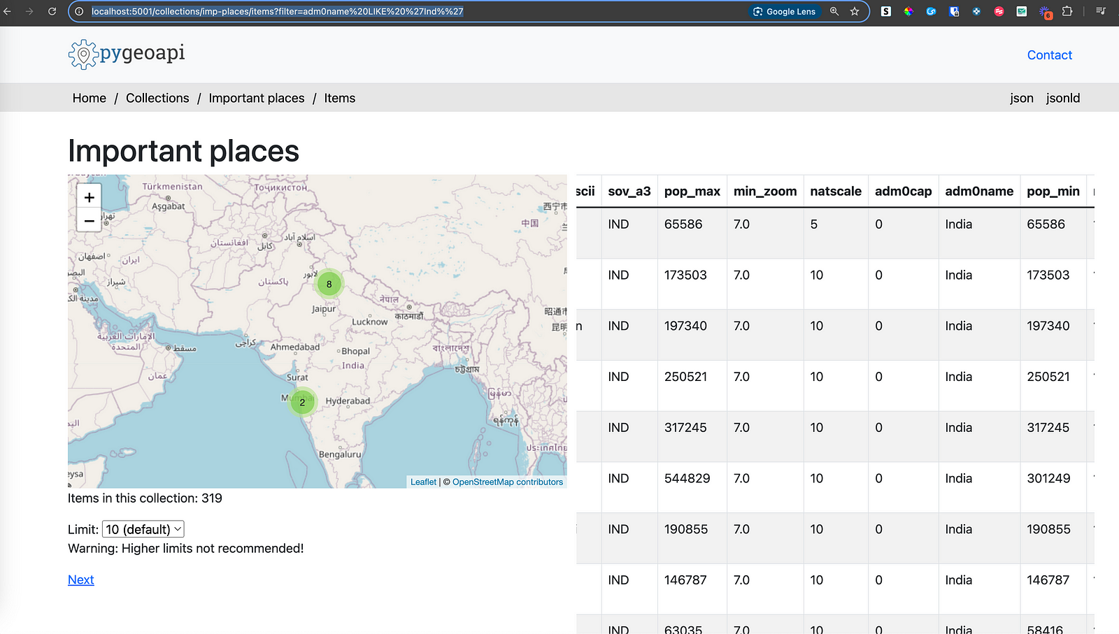
Who am I ? 🙍🏻
Hi, I’m Krishna Lodha, I’m an open source GIS Developer, Contributor and Content creator. I have my agency Rotten Grapes Pvt. Ltd. where we develop Web GIS Applications using Open source stack.
Apart from development, I upload Videos about such technologies on YouTube. I upload new blogposts every now and then on this Newsletter. Make sure you Subscribe before you leave ✅.


