

The Ultimate Guide of Downloading OSM Data using ChatGPT
Open Street Map is a collaborative mapping project that aims to create a free and editable map of the world. Unlike traditional map providers, OSM is built by a community of volunteers who contribute geographic data such as roads, buildings, parks, and points of interest. The project was founded in 2004 and has since grown exponentially, covering every corner of the globe. Every days thousands of people add new locations, update existing datasets, monitors and approves entries.
There are many applications which are using OSM data for
- Navigation and Routing:
- Urban Planning
- Humanitarian Aid
- Research and Analysis
OSM also played crucial role in currently going on Ukrain Russia war.
⛏️ How to download this data
As a GIS developer, it is always difficult to find quality data which can help us in the project. Even though OSM data is free for use in any commercial and non commercial applications [1], the real pain lies in getting this data.
There are various tools available to get this data as you can check on this wiki link
I’ll be listing few os the tools that I have used personally
🌐 Looking for huge amount of data ?
In many use cases, we want to get all the data available for a particular region, this can be as big as the complete earth 🌏 or as small as any bounding box.
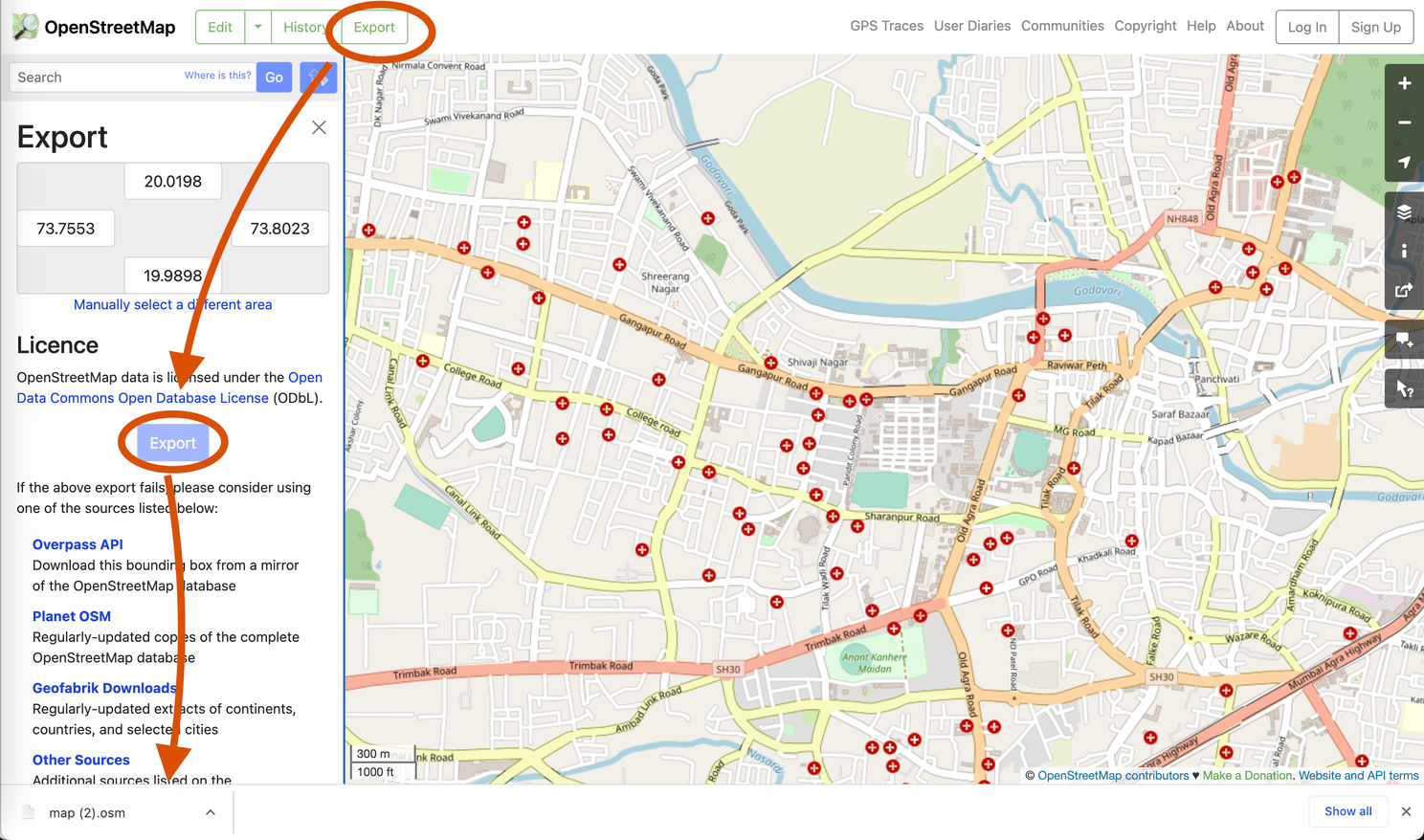
For smaller region, you can directly head to https://www.openstreetmap.org/ and locate your region and hit export. This will download data in .osm format. This data can be viewed in softwares like QGIS and can also be added to database.
To download this data, simply pan your map to the desired location and click on export , this will download map.osm file
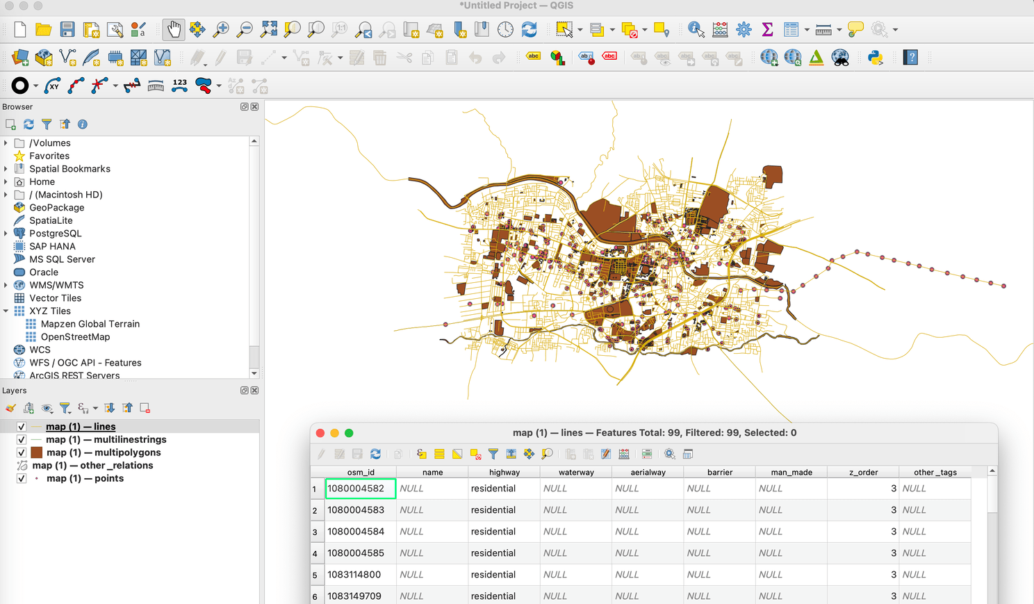
If you drag this file in QGIS, you can see various layers of point, line, polygon along with all metadata.
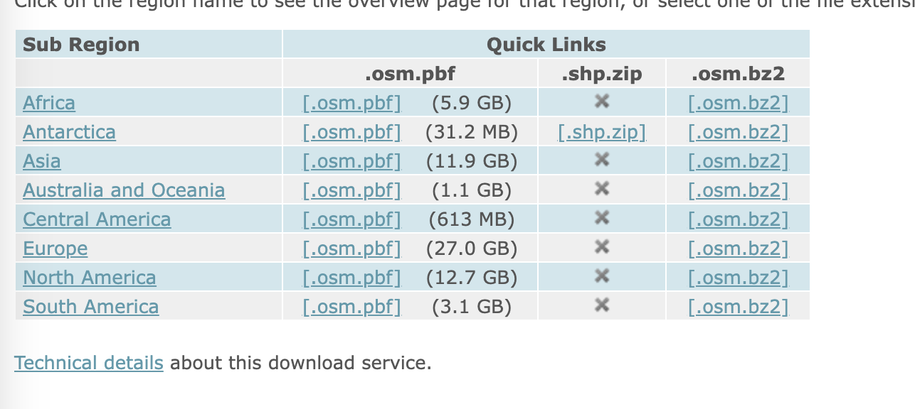
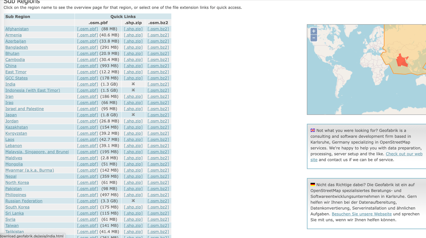
🇮🇳 Looking for country level data ?
If you want to play big league and need data for entire country or even for continent, Geofabrik can help you.
Geofabrik allows user to download data in .osm.pbf, .shp, .osm.bz2, etc.
This is very straight forward web application, where you can just click on location and download
Planet also maintains the complete data ,
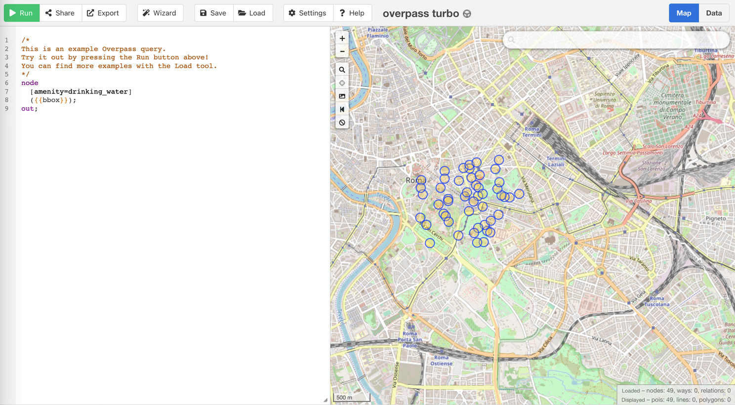
⚙️ Query data as per need ?
In many use cases, people are looking for datasets based on attributes rather than bounding box. This is where Overpass turbo is useful. It uses Overpass Query Language, to find data based on inputs for type of data, attribute filters and extent. This can be helpful for following use cases
- Get Point location all hospitals
- Get Polygon of all lakes
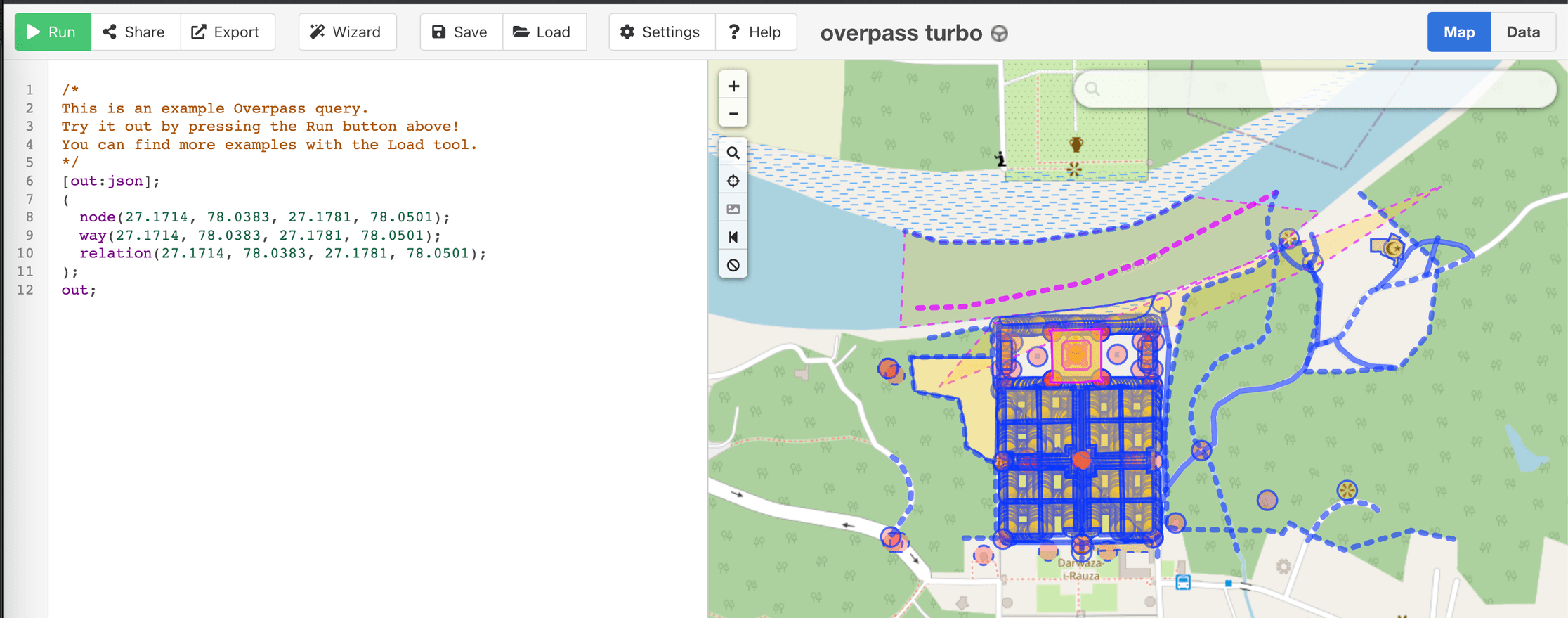
- Get all features in Taj mahal area
- Get Lines of all highways, etc.
there are various packages available for Python and node as well to integrate overpass API directly in application
🚀 Node.js
▶️ ️Query-overpass
▶️ overpass-ts
🐍 Python
▶️ overpy
▶️ overpassify
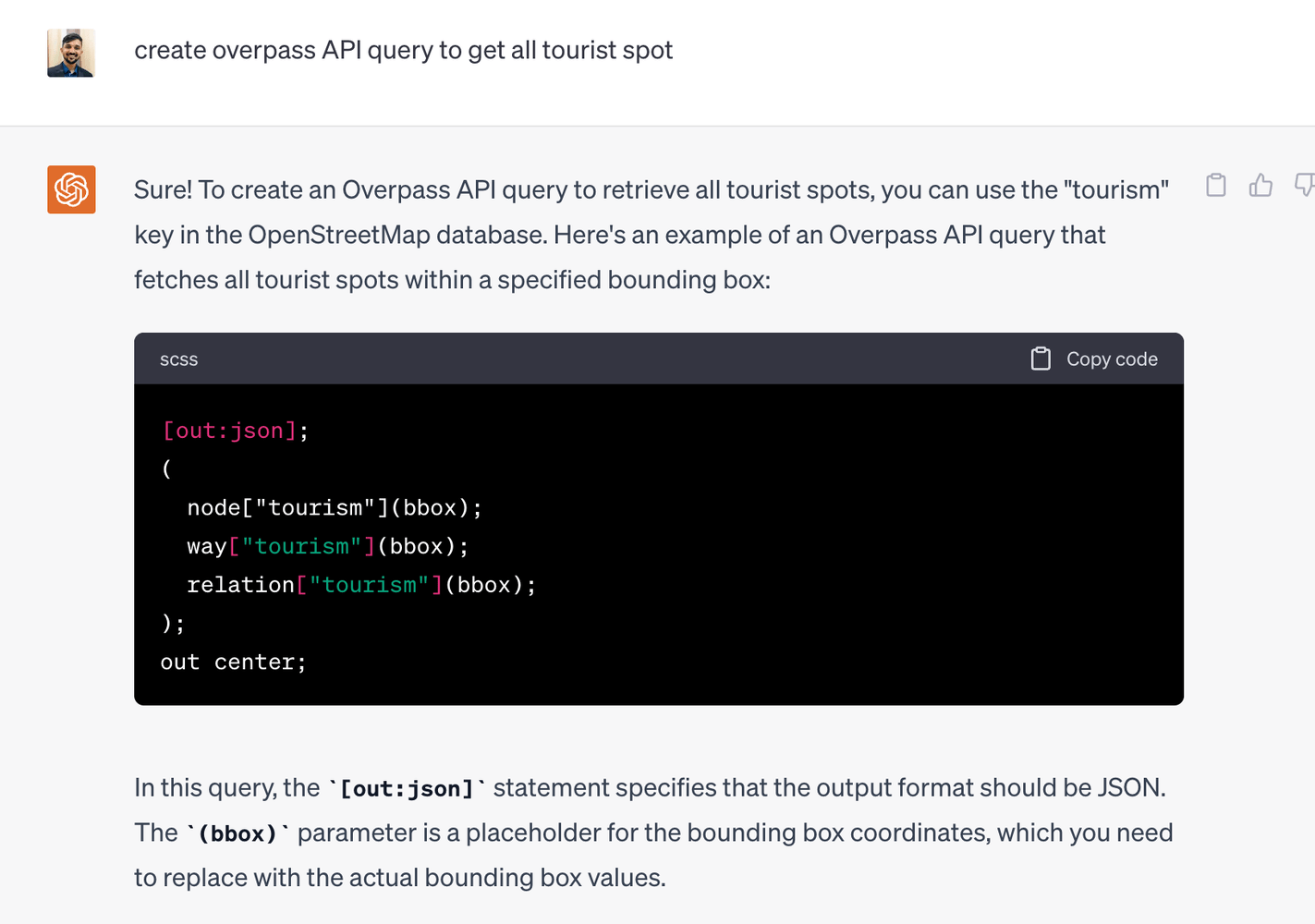
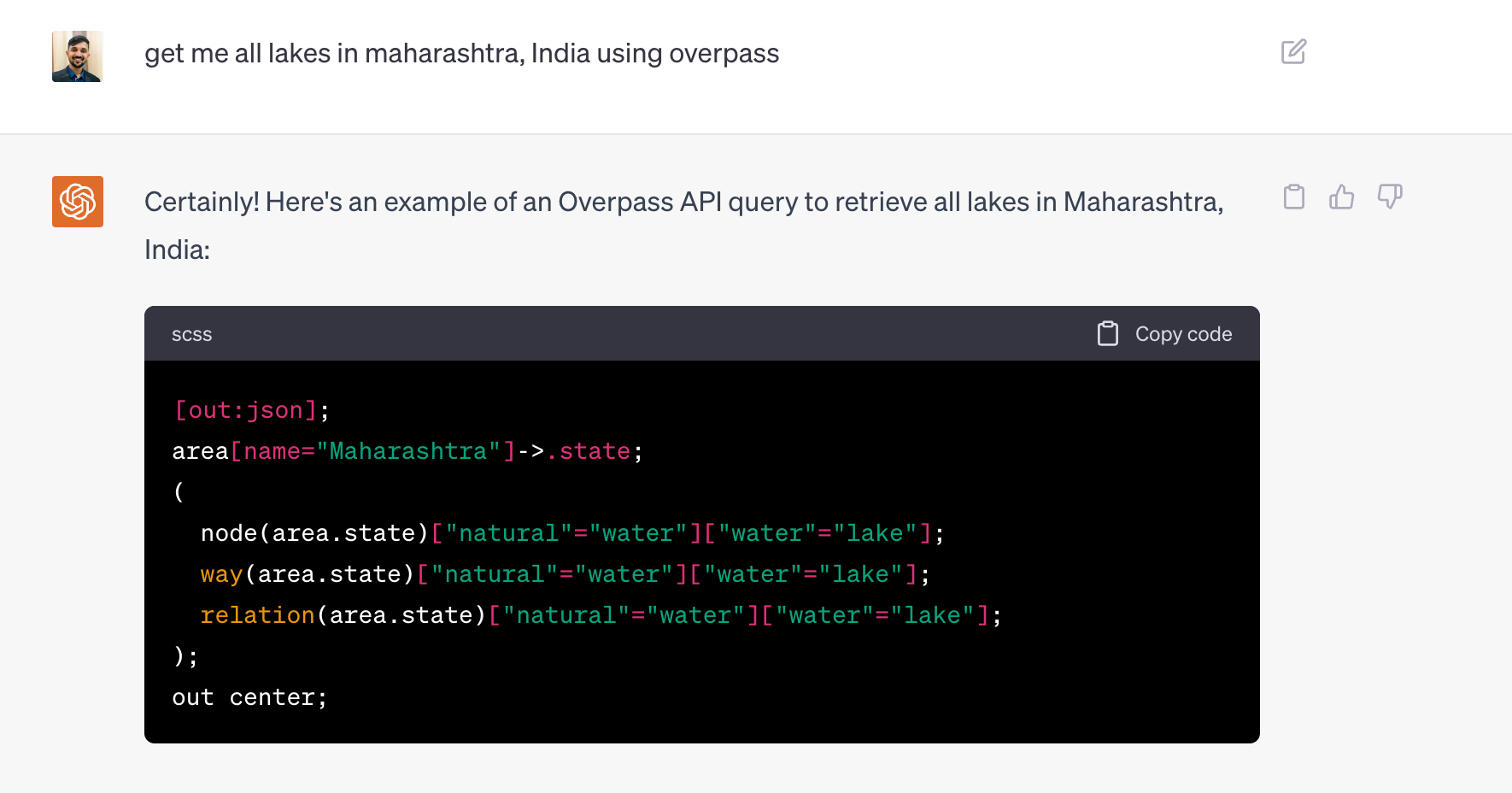
The real pain point in this method is to figure out query. If you check the overpass query language documentation, it is little bit confusing! On top of that it is also painful to find out what all attributes , values can we use to create query, etc. This is where ChatGPT makes our lives easy. Just like any other prompt , you can ask chatGPT for building query about getting necessary data.
Here are few examples
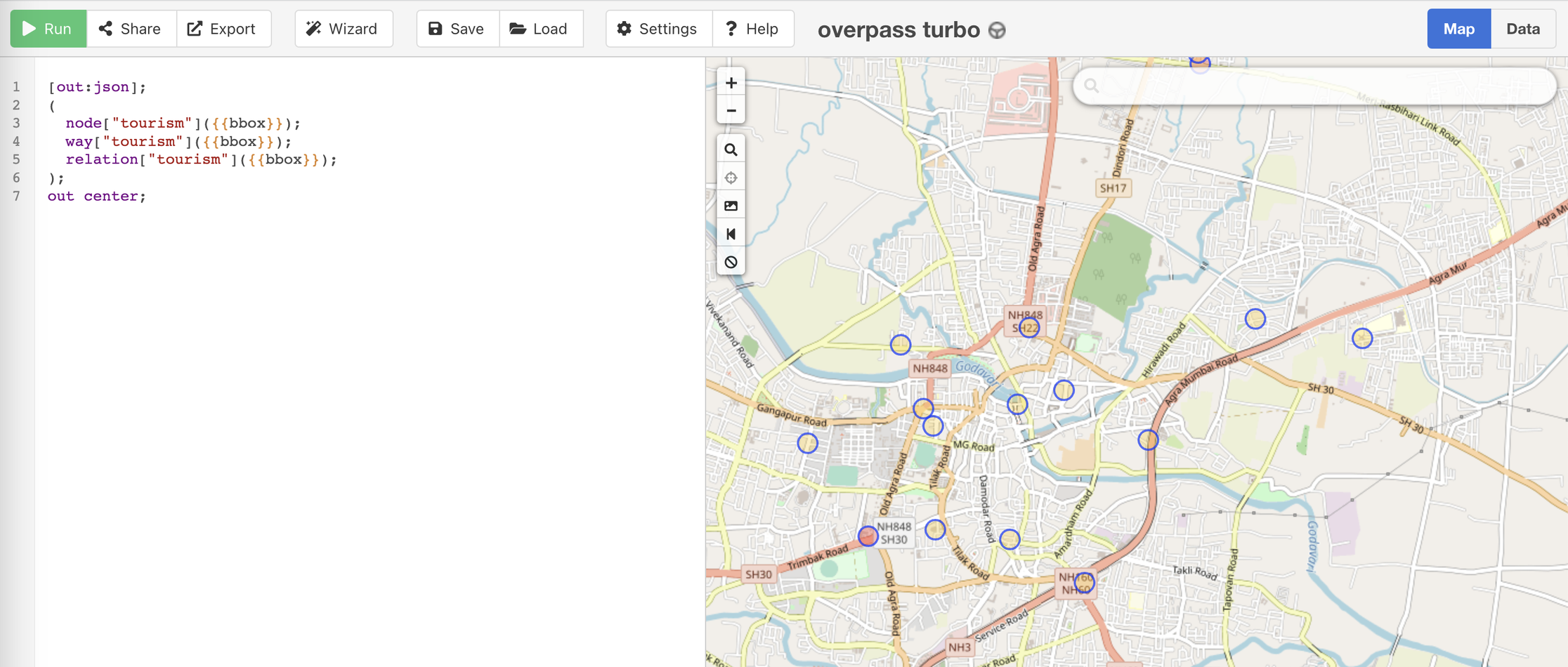
Query to get centroid point of all tourism spot for the given extent
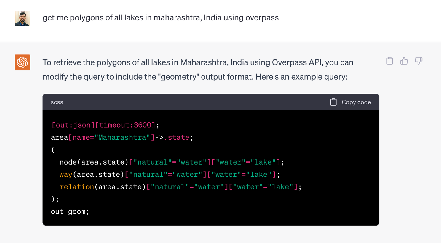
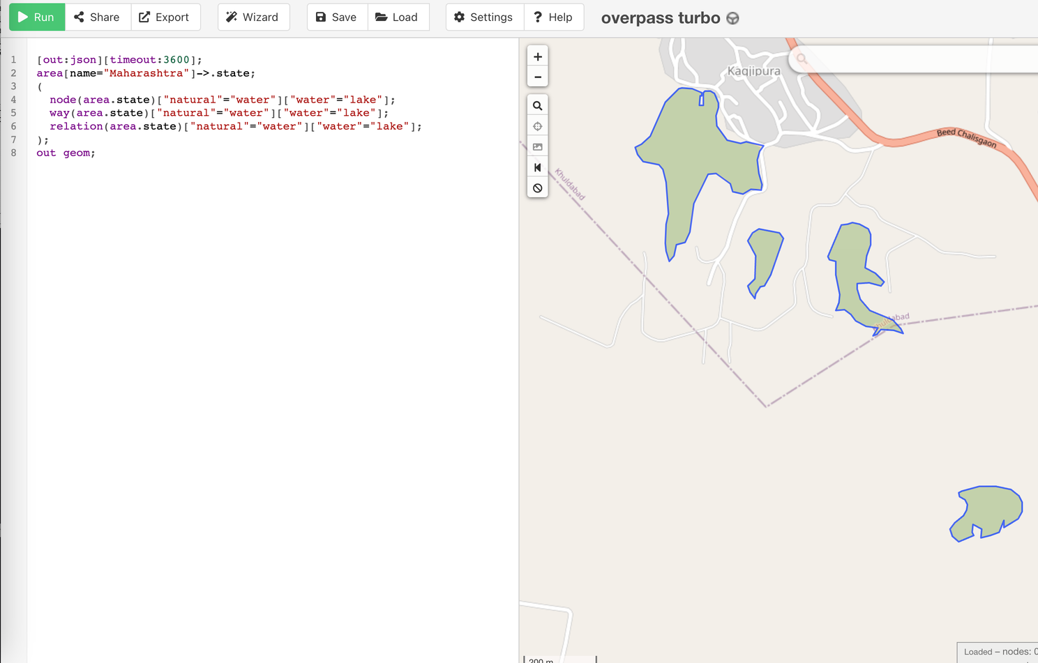
Query to get polygons of lake in Maharashtra region
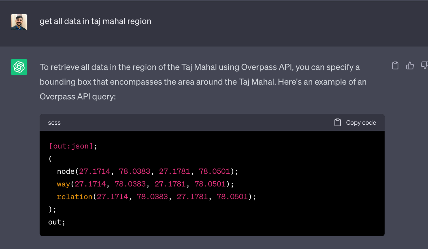
Query to get all features in Taj mahal region
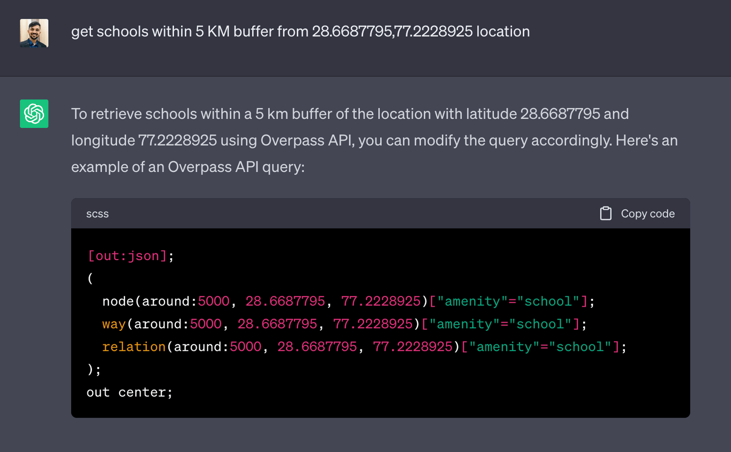
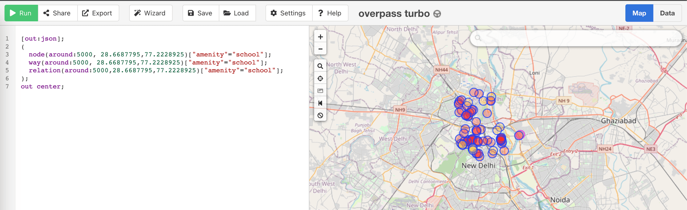
Query to get schools within 5 KM buffer from 28.6687795,77.2228925 location