From Maps to Machines That Understand Place
8 min read
By Rishikesh Mankar
open source
GIS
AIML
For most of its history, GIS has helped humans answer one fundamental question:
Where?
Where is a road?
Where is a building?
Where is a pipeline?
We built maps, spatial databases and web services to answer these questions at increasing scale.
But something fundamental is changing.
We are now building machines that can look at the physical world and ask another question:
What is happening there?
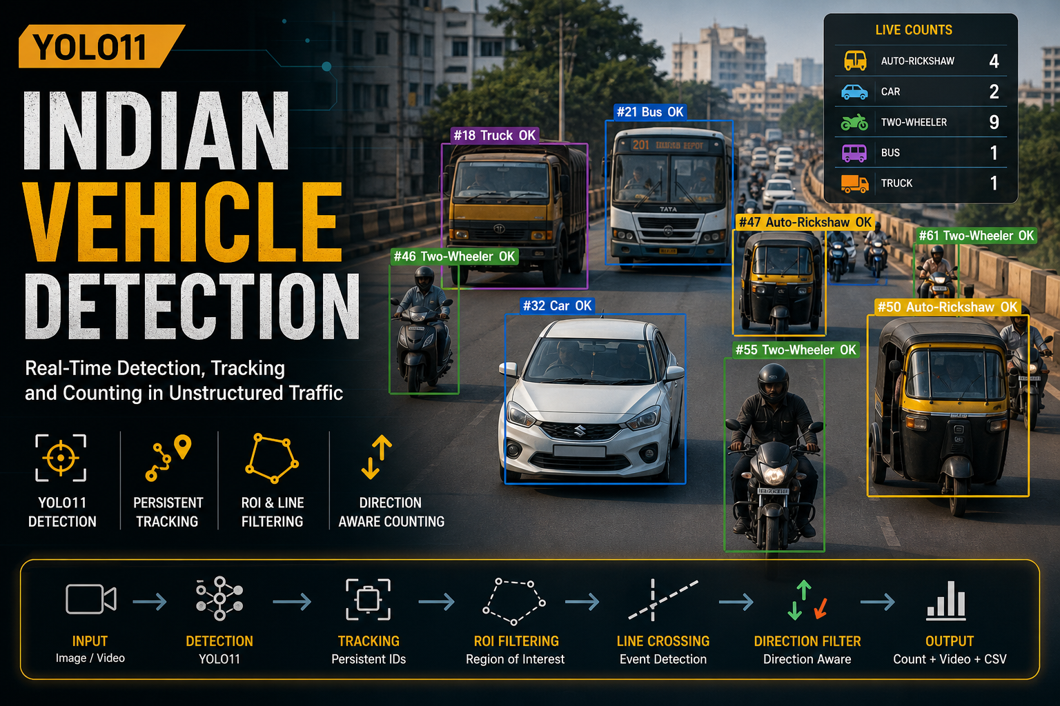
A camera can see a damaged road.
A satellite can observe a change in land cover.
A drone can identify a structure.
A sensor can detect an environmental change.
AI can increasingly interpret all of this information.
But there is a problem.
Seeing something is not the same as understanding its place.
And this is where the future of GIS becomes much more interesting.
The Difference Between Seeing and Knowing
Consider a simple photograph of a road.
A computer vision model might identify a crack with impressive accuracy.
From the perspective of computer vision, the job is largely complete.
From the perspective of GIS, it has barely started.
We still need to know:
- Where exactly is the crack?
- Which road does it belong to?
- Which carriageway?
- Which section of the road?
- How large is it?
- Was it present in the previous survey?
- Is it getting worse?
- Are similar defects concentrated nearby?
- Does the road have other associated problems?
- Who is responsible for that asset?
The difference is subtle but fundamental.
Computer vision produces an observation. GIS gives that observation a place, relationship and context.
That distinction becomes increasingly important as AI moves from isolated images into real-world environments.
A Pixel Has No Address
An image is fundamentally a collection of pixels.
A GIS feature is something different.
It has a location.
It may have geometry.
It may have a coordinate reference system.
It can have relationships with other features.
It can exist at a particular point in time.
That means transforming an AI prediction into useful geospatial information is not simply a matter of drawing a bounding box around an object.
The real pipeline looks more like:
Physical world → sensor → imagery → AI perception → spatial reference → geographic feature → spatial relationships → decision
Every transition introduces a new engineering problem.
And every transition also creates an opportunity.
This is why the future of GeoAI is unlikely to be determined by models alone.
The Model Is Not the Product
This is perhaps one of the most misunderstood aspects of AI in geospatial applications.
A model can achieve excellent results on a benchmark and still produce a poor operational system.
Why?
Because real-world geospatial problems rarely end at inference.
Imagine an organisation surveying thousands of kilometres of roads using cameras.
The AI detects pavement defects.
Now what?
If every detection remains trapped inside an image folder, the organisation has gained thousands of predictions but not necessarily much operational intelligence.
The value appears when those predictions become spatially meaningful records.
A detected crack can become a geographic feature.
That feature can be connected to a road segment.
It can be associated with previous inspections.
It can be queried.
It can be compared over time.
It can be combined with traffic, weather, construction, maintenance or asset data.
It can ultimately contribute to a decision.
The AI model is therefore one component in a much larger system.
The intelligence emerges from the system around the model.
The Rise of the Continuously Observed World
Traditional GIS has often been built around relatively stable representations of reality.
A road is represented as a line.
A building is represented as a polygon.
A utility network is represented as connected infrastructure.
But the physical world is not static.
Roads deteriorate.
Buildings change.
Vegetation grows.
Construction happens.
Traffic patterns shift.
Infrastructure is repaired, replaced or abandoned.
Historically, updating GIS meant conducting another survey, collecting new data and updating the database.
The emerging model is different.
Sensors and cameras can continuously observe the world.
AI can automatically interpret those observations.
GIS can organise them spatially and temporally.
This creates something much closer to a living geographic information system.
Instead of asking:
“What does our map say about this road?”
we can begin asking:
“What has changed on this road since we last observed it?”
That is a very different capability.
360° Cameras Are Interesting for a Different Reason
This is also why 360° imagery deserves more attention than simply being called “better imagery.”
A conventional forward-facing camera captures a particular field of view.
A 360° camera captures the surrounding scene.
For a moving vehicle, that means the observation is not restricted to what happens to be directly ahead.
The road surface, roadside infrastructure, signage, barriers, vehicles and surrounding environment can all become part of the same observation.
But the real advantage is not the number of pixels.
It is context.
Suppose an AI model identifies an object.
Knowing what surrounds that object can be just as important as identifying the object itself.
A road defect exists within a road.
A sign exists beside a road.
A barrier exists along a road segment.
A streetlight exists within an infrastructure network.
A tree may be beside a road, inside a property, or within a protected area.
The object does not exist independently.
Location creates relationships.
And those relationships are exactly what GIS is designed to represent.
Spatial Context Could Become the Next Layer of AI
Most computer vision systems are primarily concerned with the contents of an image.
Geospatial AI introduces another dimension:
context.
Consider two visually similar objects.
Individually, their pixels may look almost identical.
But their geographic surroundings may tell completely different stories.
This suggests a powerful direction for GeoAI:
Instead of asking only:
“What does this image contain?”
we can ask:
“What is this object, where is it, what surrounds it, and how does it relate to everything else?”
That is a much richer problem.
It moves AI from visual recognition toward spatial reasoning.
And this is one reason geospatial AI should not simply be treated as computer vision applied to maps.
It is a different engineering problem.
Time Turns Observations Into Intelligence
Location is only one part of the story.
The other is time.
A single observation tells us what exists.
Repeated observations tell us what changes.
Consider a road inspected every six months.
Survey 1
Three pavement defects are detected.
Survey 2
The same defects are detected, along with two new ones.
Survey 3
One defect has disappeared after maintenance.
Two have expanded.
Several new defects have appeared nearby.
Individually, these are simply detections.
Together, they form a temporal record of road condition.
Now we can begin asking more meaningful questions.
Where does deterioration happen repeatedly?
Which road sections deteriorate faster?
Which defects persist despite maintenance?
Are new defects appearing around particular locations?
This is where GIS moves beyond mapping objects.
It starts helping organisations understand processes and change.
The Spatial Database Becomes More Important, Not Less
There is a tendency to think that AI will eventually replace traditional GIS components.
The opposite may be closer to reality.
As AI generates more observations, the need to organise those observations becomes greater.
A model may generate millions of detections.
Without a system to store, index, query, relate and govern them, those detections quickly become another data problem.
Spatial databases become the connective tissue.
They can allow AI-generated observations to coexist with:
- road networks
- administrative boundaries
- asset inventories
- satellite imagery
- survey data
- sensor observations
- historical inspections
- demographic information
- environmental datasets
The result is not simply an AI dataset.
It is a spatial knowledge layer.
And that layer can become increasingly valuable as more AI systems begin producing geographic observations.
This Changes the Meaning of a Map
For a long time, a map was primarily a visual interface to geographic information.
But a map can now become an interface to something much larger.
Imagine selecting a road segment and seeing not just its geometry, but:
- the latest imagery
- detected defects
- historical defects
- maintenance events
- nearby assets
- environmental conditions
- changes detected by satellite
- confidence scores from AI models
- inspection history
The map is no longer simply showing geography.
It is providing access to a machine-generated understanding of geography.
That is a fundamental shift.
But There Is a Hard Problem Hiding Underneath
There is an uncomfortable truth about GeoAI:
AI makes bad geospatial data scalable.
If the source data is inconsistent, poorly labelled or incorrectly positioned, an AI system can process that bad information faster than any human could.
A model trained on biased samples can systematically reproduce those biases.
A detection with incorrect georeferencing can become an incorrect geographic record.
A model trained on one environment may behave differently in another.
This is why AI-readiness is increasingly becoming a data architecture problem, not simply a model-selection problem.
OGC's current work reflects this direction. Its GeoAI work explicitly addresses interoperability, training data and machine-readable geospatial information, while its recent work on AI-ready geospatial data focuses on making data usable not only by people and organisations, but increasingly by automated systems and AI.
Even training data itself is becoming a standards problem. OGC's TrainingDML-AI work addresses how geospatial ML training data can capture things such as provenance, quality, ground-truth labelling and information specific to different ML tasks.
This matters because trustworthy AI requires more than a trustworthy model.
It requires trustworthy inputs, traceable processes and interpretable outputs.
From GIS to GeoAI
Perhaps the biggest change is conceptual.
Traditional GIS largely asks:
What exists where?
Spatial analytics asks:
What relationships exist between things?
AI adds:
What can we infer from what we observe?
And the combination creates something more powerful:
What is happening, where is it happening, why might it be happening, and what should we do about it?
That is the direction in which GeoAI can evolve.
Not simply automated mapping.
Not simply object detection.
Not simply putting an AI model inside a GIS application.
But building systems where machines can observe, interpret and reason about geographically referenced reality.
The Next GIS May Not Look Like GIS
The GIS of the future may contain fewer moments where someone manually creates a feature on a map.
Instead, geographic information may increasingly emerge from observation.
A camera sees.
A satellite observes.
A sensor measures.
An AI model interprets.
A spatial system contextualises.
And humans make decisions.
The map remains—but increasingly as the interface to a much larger spatial intelligence system.
This does not make GIS less important.
It makes the underlying geospatial infrastructure more important than ever.
Because if machines are going to make decisions about the physical world, they need more than pixels.
They need coordinates.
They need context.
They need time.
They need relationships.
They need standards.
And they need reliable geographic data.
The Real Opportunity
The most interesting question for the geospatial industry may therefore not be:
“How can we put AI into GIS?”
It may be:
“How can we build GIS systems that allow AI to understand the world?”
That is a much bigger question.
It moves the conversation from models to infrastructure.
From images to observations.
From observations to geographic features.
From features to relationships.
And from static maps to continuously evolving representations of the real world.
The ultimate goal isn't to make machines better at looking at maps.
It is to make machines better at understanding place.
And when that happens, GIS stops being only a system for describing the world.
It becomes part of the system through which machines perceive, understand and help us manage it.